Teaming Up to Scale Up: Laying the Groundwork for a NEON-NASA Collaboration
October 5, 2011
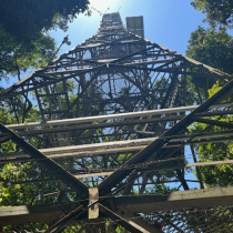
NEON’s Airborne Observation Platform (AOP) team went to unusual heights in late September, taking only ground-based observations in the first of several planned collaborations with NASA. The team traveled to California’s San Joaquin Valley and southern Sierra Nevada to collect ground-based spectrometer and atmospheric measurements in parallel with a flyover of the same area with an airborne NASA spectrometer. NEON’s participation in NASA’s Hyperspectral Infrared Imager (HyspIRI) Early Climate Data flight campaign is a unique opportunity to work with the NASA HyspIRI team to obtain spectroscopic data that is mutually beneficial to the science pursuits of both programs.
In partnering with other research experts such as NASA to acquire ground validation and vegetation data as part of this flight campaign, NEON will further refine its protocols, begin establishing baseline vegetation information for the NEON sites in this domain, and acquire a combined field and airborne data set suitable for developing regional-to-continental scaling methodologies Activities during this particular mission included: (1) identification and characterization of ground sites for radiometric calibration, (2) use of a field spectrometer to provide ground truth radiometric calibration data, and (3) identification and mapping of plant species and tree stands using the field spectrometer. The ground-based measurements collected by the NEON AOP team can be used to calibrate the campaign data. The two data sets may also help NEON understand how different vegetation properties may be derived from remotely sensed data. A proposed flight campaign with the NASA Airborne Visible/Infrared Imaging Spectrometer (AVIRIS) flying at high altitude would obtain further data over California during the next few years. The campaign data would be used to demonstrate the utility of HyspIRI data and to begin developing geophysical science tools suitable for use by NEON, HyspIRI and other scientists over a broad range of ecosystems.
In the near future, NEON expects to fly waveform LiDAR and its own visible/shortwave-infrared imaging spectrometer aboard a Twin Otter plane at low altitude over additional NEON sites to obtain high-resolution data sets. The combination of ground-based spectral data, LiDAR information, and spectroscopic information collected by NEON and NASA remote sensing instruments provides a multi-scale data set ideal for use in addressing data scaling issues critical to the NEON mission of studying the impacts of land use, invasive species and climate change at continental scale.
