Taking a hike before I fly
October 13, 2011
By Keith Krause
It’s hot. Like, 100 degrees F hot. And I’m carrying around this heavy, ultra nerdy backpack (which engineering school definitely prepared me for) with a laptop slung around my neck. As I make my way through the field at San Joaquin Experimental Range (SJER), waves of grasshoppers take to the air in hopes of avoiding my unforgiving boots. Even though I’ve got grass seeds poking me through my socks, I keep wading through the sometimes waist-high grasses to finish my measurements. Oh good, now I need to climb through a barbed wire fence to take some different measurements. As I pass off the backpack and laptop to my coworker I notice one of the biggest spiders I’ve ever seen, just chillin’ in the grass to my right (which makes me wonder how many more are just lying in wait in the grass I’ve been walking through all day).
Believe it or not, I’m actually really glad that I get to do these things as part of my job as the Airborne Observation Platform’s lab technician (aside from the part with the spider, yeesh). This was just one of the days that we (that is, the AOP team) recently spent out at Domain 17. We were out at the core and re-locatable sites to take a couple of types of ground-based measurements while JPL's AVIRIS flew above us. We used our CIMEL sun photometer to measure the amount of radiance that reaches the ground through the atmosphere. And that big ol’ nerdy backpack? That’s the ASD, which we used to measure the reflectance of various plants at the sites. These ground-based measurements will help us determine what’s what as we analyze future airborne measurements (i.e. is that soft chess or wild oats?), and by comparing the data to what is collected by the airborne sensor they will serve as a form of calibration for our airborne payload.
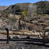
The D17 sites (SJER, Soaproot Saddle and Upper Teakettle) were chosen to study the effects of climate change at various elevations. We measured the reflectance of grasses, two types of oak and gray pine (among other things) at SJER and, as we went to higher elevations at Soaproot Saddle and Upper Teakettle, switched to the likes of cedar, manzanita and fir. With the change in vegetation, Soaproot Saddle and Upper Teakettle also provided a very welcome respite from the heat, the opportunity to stand next to giant Sequoia trees and the occasional hunter sighting. Granted, this isn’t exactly a typical day for me, especially since our data will be taken during “peak greenness” and it’s now the beginning of October. So I do have to spend some time in the lab as a lab technician – go figure. Now that the NEON project is funded for construction, the AOP lab is coming together: within the next few months we’ll have the instrumentation to make up our first airborne payload (imaging spectrometer, wLiDAR, and camera), and we’re hoping to get some wind beneath a Twin Otter’s wings this coming spring and summer. Before we can start our own test flights, I’ll be busy learning how to operate the payload, helping to calibrate it in a variety of ways and working to optimize the field measurement processes. And when our test flight season does roll around, I’ll get to fly the plane! Just kidding…but I will get to fly in the plane. Not a bad gig for a lab tech.

